Newfound Gap Road
A Stunning Scenic Drive in the Great Smoky Mountains National Park
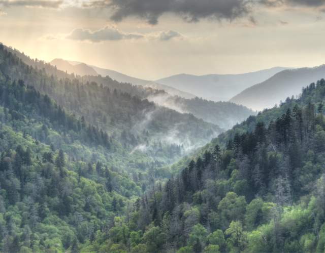
Newfound Gap Road, also known as US Highway 441, connects Cherokee, NC to Gatlinburg, TN. This 33 mile scenic drive takes you up and over the Great Smoky Mountains. There are ample turn outs and photography opportunities as you drive the Newfound Gap Road. Upon entering the Park in Cherokee, make sure to stop at the Oconaluftee Visitor Center and Mountain Farm Museum. Just one mile north of the visitor center on Newfound Gap Road, is Mingus Mill.
Traveling north along US 441/Newfound Gap Road reveals a plethora of winding roads and higher-elevation views of mountain layers. As you continue to climb to the higher elevations of the Park, where long range views of mountain ridges are plentiful. Most of these overlooks and parking areas will be on the left side, the first one being Charles Webb Overlook, followed by Swinging Bridges Overlooks..
Oconaluftee Valley Overlook provides stunning mountain landscape scenery. Photographers love this spot for sunrise photos. Next up on the left, is the turn for Kuwohi (Formerly Known as Clingmans Dome). This 7-mile stretch of scenic roadway takes you to the Kuwohi Observation Tower, the highest point in the Great Smoky Mountains National Park.
Return to Newfound Gap Road from Kuwohi. Continuing north on Newfound Gap Road is another gorgeous overlook with some history, and appropriately named Newfound Gap Overlook. The North Carolina/Tennessee border is located here, along with stunning views from the parking lot. A public restroom is adjacent to the parking lot.
Just past Newfound Gap, is Morton Overlook, a great spot for sunset views.
On the way down the mountain toward Gatlinburg, the winding road takes you through forested mountain sides and tunnels. Near Gatlinburg, be on the lookout for Little River Road, which provides access to Elkmont, Tremont, Greenbrier, and Cades Cove.
To return to Cherokee and Bryson City, just take the same road back - US 441 S/Newfound Gap Road. When it’s time to head back to Bryson City make sure to go slowly by the Oconaluftee Visitor Center to see the Elk that might be roaming in the Fields.
In the listing grid below, be sure to click on "show map" for a Google map to follow along.
Take the Scenic Route: Your Guide to Picture-Perfect Drives Near Bryson City
- 7 minute read
Embarking on a Great American Road Trip is a quintessential vacation experience. Piling in the car…
More Scenic Drives To Explore
Blue Ridge Parkway
The Blue Ridge Parkway has several access points near Bryson City
Scenic Byway - The Nantahala Gorge
Drive the scenic Nantahala River Gorge to view beautiful river scenes, whitewater…
Road to Nowhere
Venture Into History One of the most unique areas in Bryson City is found on Lakeview…
Clingmans Dome Road
Clingmans Dome Road takes you on a scenic journey to the highest point in the…
Hellbender 28
North Carolina Highway 28 N twists and turns its way through the Smokies and near…
Cherohala Skyway
This scenic highway features spectacular mountain views with multiple overlooks.
Tail of the Dragon
Test your wheels on the Dragon, a thrilling drive with 318 curves in just 11 miles…
Little River Road
This 18-mile scenic drive dead-ends at Cades Cove, and provides spectacular scenery…
Roaring Fork Motor Nature Tour
The 5.5-mile-long, one-way, loop road is a favorite slow drive for many people. It…
Cades Cove Scenic Loop
Cades Cove Scenic Loop can be traveled by car or bicycle. Explore historic structures…


